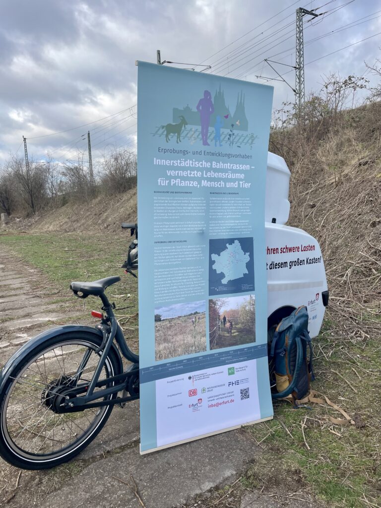
Testing and development project
“Inner-city railroad lines – networked habitats for plants, humans and animals”
Introduction and background
In Germany, the areas alongside railway lines offer enormous potential for urban planning and nature conservation, particularly in densely populated urban areas. Networking of biotopes significantly contributes to the preservation and promotion of biological diversity. These networked biotopes enable migration and exchange movements of populations among species, thereby fostering genetic diversity. This is particularly important for maintaining genetic diversity and can promote resilience to diseases or extinction of valuable species, for example through recolonization from neighboring populations (Drobnik et al. 2013: 28 ff., 56 ff).
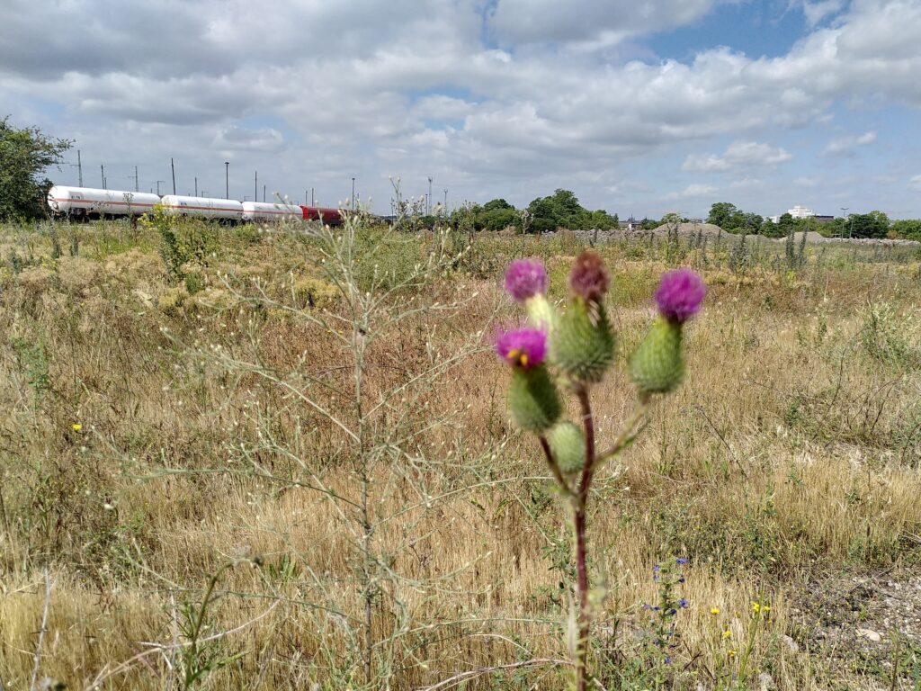
However, as a result of significant human interference in nature brought on by increasing urbanization, such as soil surface sealing and excessive use of natural resources, vital ecosystems are either lost or severely fragmented by impassable barriers. Cities are examples of such barriers on a regional scale. Meanwhile, substantial agricultural use is resulting in the depletion of essential habitats in rural regions. Considering cities themselves, they can provide a multitude of structures and niches that can accommodate different animal and plant species; the challenges posed by human influences and increasing urbanization require new approaches to increase the permeability of urban spaces through biotope networks. This, in turn, can help to enhance accessibility to the existing ecosystems on both sides of the city boundaries. The utilization of existing, continuous structures for the biotope network can serve as a sensible starting point. Such structures can be provided by river courses within cities, for example. Railroad lines also have a natural corridor character due to their cross-regional continuity. Railway and railway-accompanying areas often have similar ecological conditions to dry habitats and function as steppingstones or corridors due to their connecting character. Due to their structure, similar climatic, geological and topographic factors can be found along railroad lines as in dry grassland areas. Dry open land biotopes are sometimes characterized by extreme local conditions, such as a dry and warmer than average local climate, permeable substrate, and less fertile soils, which promote the colonization of floristic and faunistic specialists. Consequently, railroad lines can provide suitable conditions for the biotope network of dry habitats by creating narrow corridors that facilitate high diversity of species within the city.
Project goal
The focus will be concentrated on inner-city areas, especially those that can be used for multiple purposes to counter the growing pressure on space within cities. In other words, the aim is to create places of recreation and education for the benefit of the public and to promote biodiversity by supporting/promoting habitats in a manner that people and nature can seamlessly interact with each other. These linear structures can facilitate the movement and establishment of a
novel set of species, many of which are disturbance-tolerant generalists, leading to the formation of new interaction networks within these man-made habitats (Dornelas et al. 2014; Lembrechts et al. 2017). While the species composition in these areas may differ remarkably from that of more natural habitats, such as dry grassland, the presence of these species contributes to the overall ecological mosaic of the landscape.
Specific focus on Erfurt
There is a long tradition of documenting biological diversity in Erfurt. The first „Flora“ of Erfurt was produced already in 1914 (Reinecke 1914). According to the findings of Bößneck (2015: 7) 58% of higher plants, 59 % of birds, 58 % of beetles, 72 % of dragonflies and 65% of grasshoppers of the species recorded throughout Thuringia were found in the city of Erfurt. After 1990, 765 higher plants were located in the city area of Erfurt (Kümmerling 2007). This amazingly high number of species is due to the diversity of habitats – semi-natural woodlands, meadows, parks, railway areas, building sites (Rebecca D Ennhöfer, Norbert Müller, Anita Kirmer & Rüdiger Kirsten, May 2008). In order to establish a meaningful connection between the surrounding natural areas and the city infrastructure, it is important to create suitable landscape structures within the city’s urban areas as they have the potential to enhance biodiversity.
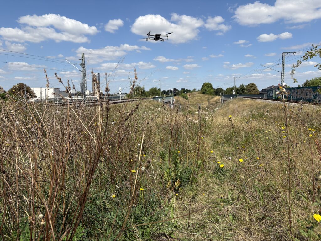
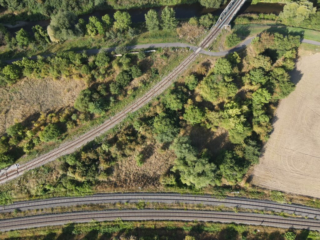
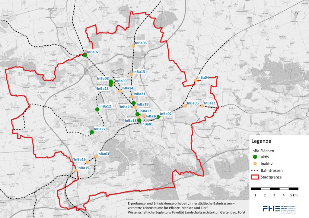
This requires new approaches, meanwhile meticulously considering the increasing competition for space in cities makes it necessary to enable multifunctional use. Numerous active and inactive train lines intersect the urban region in Erfurt (see Figure 1). However, their potential for biotope connection has not yet been investigated.
Moreover, Erfurt also has dry grassland areas in the north and south of the city that are protected at state and national level. These should be made accessible to dry grassland species through an inner-city biotope network through in Erfurt. Thuringia is home to 43% of the dry grasslands recorded nationwide (Baumbach & Pfützenreuter 2013: 24), which underlines the need for permeable cities in this state.
Preliminary Investigations and Main Project
The preliminary study goals included: Firstly, potential railway-associated sites were to be identified, with a focus on assessing their accessibility. Secondly, the potential for biotope networking was to be determined. Thirdly, area-specific measures were to be developed. Fourthly, stakeholders were to be identified, and fifthly, a robust cooperative relationship with Deutsche Bahn AG was to be cultivated.
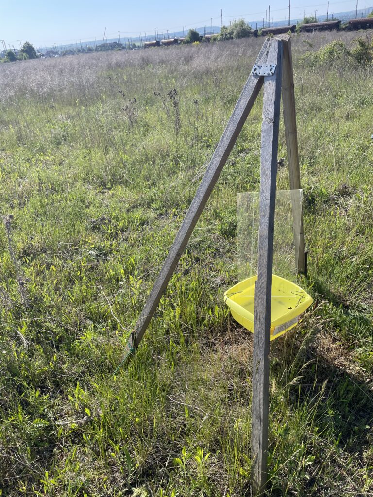
Moreover, extensive faunistic-floristic assessments have been conducted on various sites within the city of Erfurt (see Figure 1: yellow and green sites). These investigations laid the foundation for the main project, where measures to establish a biotope network are being implemented and scientifically monitored (see Figure 1: green sites).
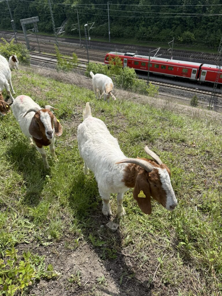
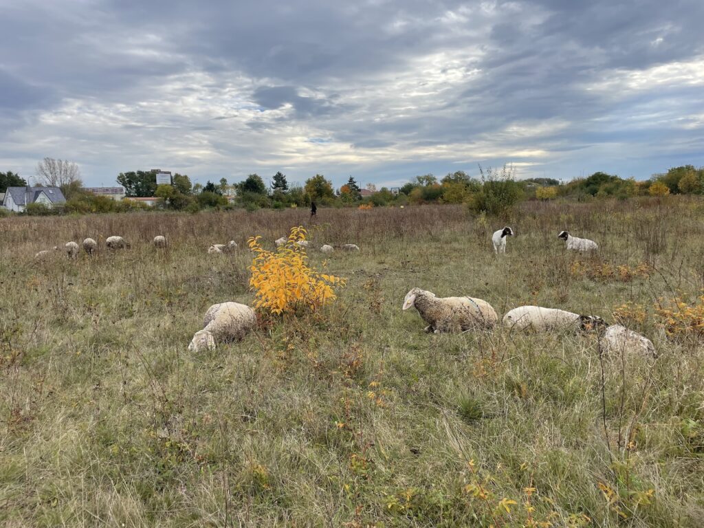
The combination of nature conservation and anthropogenic use offers the opportunity to strengthen people’s connection with nature. Conscious, transparent nature conservation in areas used for recreation, and other purposes can facilitate low-threshold, non-formal education. This leads to more knowledge about species and their habitat requirements, which in turn strengthens people’s desire to preserve these species: “I only love what I know, and I only protect what I love.”(Konrad Lorenz).
The development of synergy effects between anthropogenic use and nature conservation leads to the creation of multifunctional areas. These make a positive contribution to the biotope network, local recreation and education for sustainable development and thus relieve the increasing land pressure in urban areas (Schlesselmann 2023:111).
The objectives of the preliminary study were therefore
- to examine the direct and indirect connections between areas with the railway lines,
- to determine the potential for the biotope network,
- the development of area-specific measures for the main project
- the identification of stakeholders and
- establishing a stable partnership with Deutsche Bahn AG
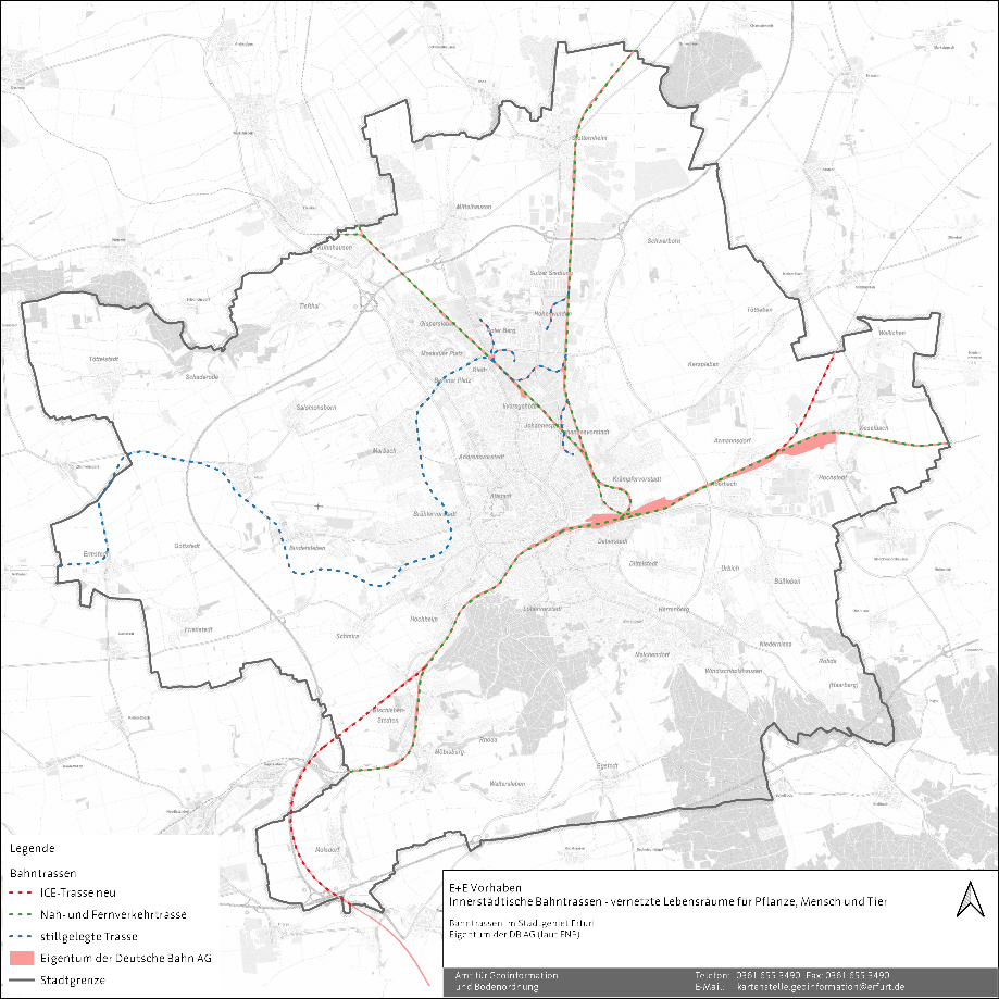
These investigations and the subsequently selected areas form the basis for further action as part of the main project, which will implement measures to develop these sites (see Figure 2).
In addition, the preliminary investigation results form the basis for the associated accompanying scientific investigations, which serve to verify the success of the measures. In the implementation phase of the main project corresponding measures will be implemented as examples and scientifically monitored.
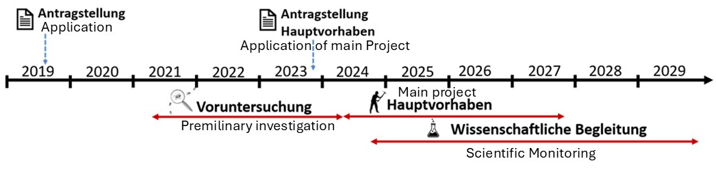
Timeline for the Project
- 1. Preparation Phase:
- Conducting preliminary investigations
- Determining the potential for the biotope network
- Developing area-specific measures
- Identifying stakeholders and partnering with Deutsche Bahn
- 2. Implementation Phase (Main Project):
- Implementation of selected measures
- Scientific monitoring and verification of the success of the measures
- 3. Conclusion Phase:
- Evaluation of the scientific monitoring
- Adjustment and continuation of the successfully implemented measures